Standard Height Data
Our detailed digital terrain and surface models (DTM and DSM) of England and Wales is available as a grid of heighted points and contours, both at 5m intervals (for the DTM) and 25cm intervals (for the DSM).
Whether you’re interested in the terrain, or surface features such as buildings and trees, our data provides detailed height measurements at high accuracy and resolution. Bluesky height data facilitates the understanding, analysis and management of the environment that surrounds us.
Bluesky has an unrivalled National catalogue of height data, which ensures that no matter where your area of interest is, we can provide you with the right information for your application. The data can be provided in a number of formats, enabling utilisation across a variety of software packages.
Specification
-
Photogrammetrically derived
-
Highly detailed
-
DTM at 5m post spacing (no buildings or trees)
-
DSM at 25cm post spacing (full surface model)
-
High accuracy
-
Maintained and continually updated
-
OSGB projection as standard
-
National DTM and DSM coverage
-
Available in many formats: ASCII XYZ, ARC Grid, GeoTIFF, 3DS
Applications
-
Flood risk assessment
-
Run-off mapping
-
Quarrying, mining & volumetrics
-
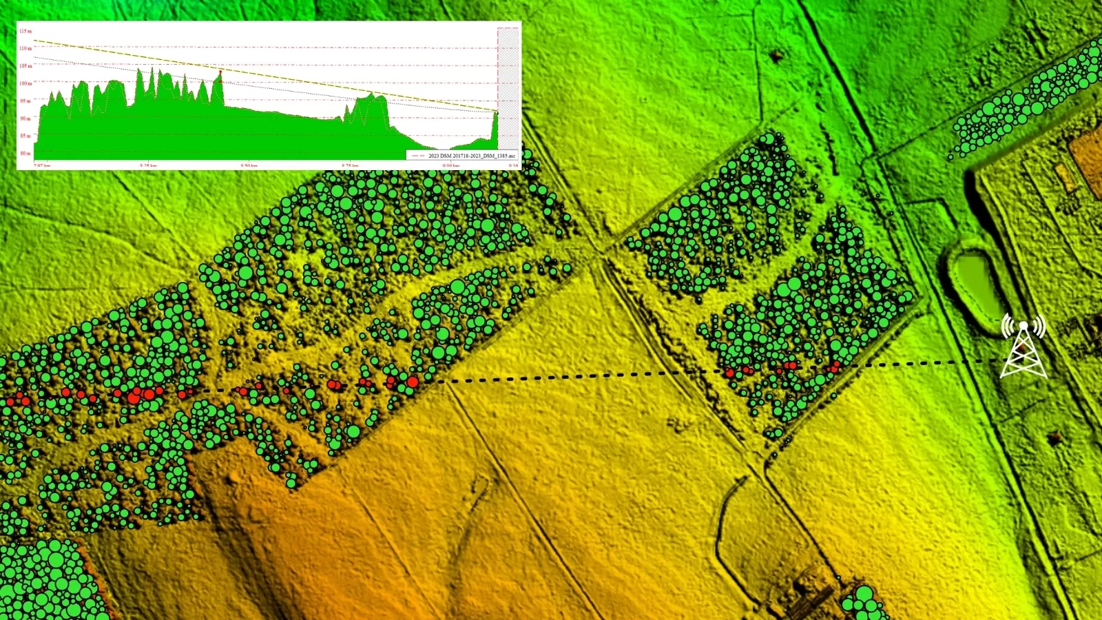
Mobile network planning
-
Line of sight
-
Noise and emissions modelling
-
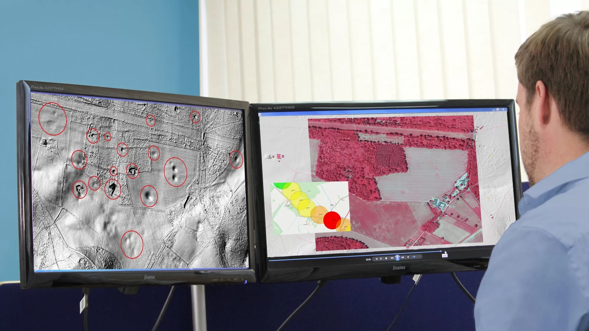
Visualisation and view-shed analysis
-
Wind farm planning
Benefits
-
Off-the-shelf coverage
-
High accuracy
-
Ongoing update programme
-
Available for instant download
-
GIS and CAD Ready
-
Compatible with Ordnance Survey products
-
Flexible licensing terms
Standard Height Data products

The terrain excluding buildings and vegetation, at a 5m grid spacing

The full surface including buildings and vegetation, at a 25cm grid spacing

Slope - this identifies the value of maximum downhill decent from the horizontal
Aspect - identifies the horizontal direction of slope