3D Building Models
Bluesky has direct access to the largest collection of high resolution stereo aerial photography in the UK, and we are therefore ideally placed to provide cost-effective, accurate and detailed 3D models of the urban environment, using advanced photogrammetric techniques.
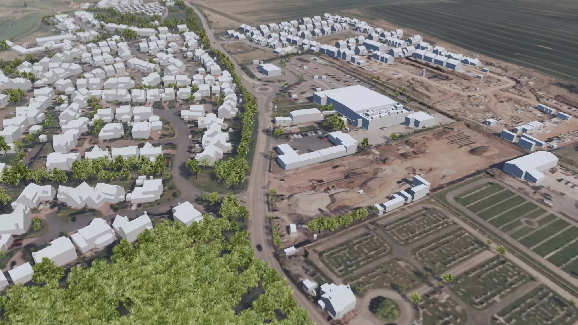
Bluesky’s 3D building models provide a detailed visual representation of the built environment, allowing interaction, analysis and interrogation of our urban landscapes on an unprecedented level. The data can be provided at a variety of levels of detail and are tailored to your own specifications. All models include a detailed terrain model.
Derived photogrammetrically from our high resolution stereo aerial photography, our 3D building models are geographically accurate and specifically designed to support developers, architects and urban planners in making efficient, cost-effective and informed decisions about the urban environment.
New technology and advances in image processing allow automated, fully rendered 3D models of entire cities at a fraction of the cost that they were in the past.
Specification
-
3D building and city models for CAD & GIS
-
LOD1, LOD2 & LOD3 as standard
-
Wireframe or block models
-
DWG format as standard
-
Other formats available
-
OSGB Projection
Applications
-
Modelling & Simulation
-
Urban and master planning
-
Shading and viewshed analysis
-
Architecture
-
Security and counter terrorism
-
Power lines & Utilities
-
Transport
-
Flood modelling
-
Renewable energy
Benefits
-
National coverage
-
Flexible licensing
-
Connectivity & Interoperability
-
CAD ready
-
Compatible with Ordnance Survey products
All Bluesky 3D models are compatible with GIS and CAD software, such as AutoCAD, Microstation, ArcGIS, MapInfo and Google SketchUp, as well as specialist visualisation packages including 3D Studio Max, Rhino and Maya.
Whatever level of detail you need, Bluesky 3D models can help. We produce our models at three distinct levels of detail (LOD):
LOD1 models: 3D block buildings, including accurate terrain
LOD2 models: 3D buildings with accurate pitched or flat roof shapes, including accurate terrain
LOD3 models: 3D buildings with accurate pitched or flat roof shapes with detail such as dormer windows and chimneys, including accurate terrain
Accompanying terrain information is always created at the same time, which ensures the most realistic 3D environment is supplied with every model. You can also enhance the model with our additional layer to provide a higher level of detail.
Additional layer: Roads, pavements, parking, trees, water, bridges and rail

Levels of detail