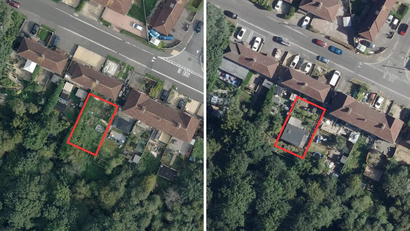
Aerial Photography
Aerial photography continues to play a vital role across a variety of disciplines, whether it be environmental management, policy implementation, planning, enforcement, or network analysis. Now more than ever it is part of everyday life through online mapping portals, and extensive use in both printed and digital media.
Bluesky’s catalogue of high resolution orthophotos is accurate, up to date and GIS/CAD ready. It is produced to the highest standards, accredited by the Ordnance Survey.
Whatever your application, Bluesky has your area of interest covered by orthorectified aerial photography. We are specialists in the acquisition and processing of aerial photography and in the creation of high quality digital imagery and terrain products. Bluesky is committed to investing in the latest capture and production technologies, and by doing this we ensure the aerial photography products and services we provide are second to none.
Our catalogue of national aerial photography, available off-the-shelf and covering the whole of Great Britain. We are continually refreshing our coverage through our cyclic update program, giving our photography unparalleled currency.
Specification
-
True orthorectified 12.5cm national resolution
-
2.5cm and 5cm hi-res available for select cities
-
Accuracy + / – 0.5m RMSE
-
Many formats (incl. JPG, TIF, ECW, KMZ)
-
OSGB1936 projection
-
2-year update programme
Applications
-
Town Planning & Enforcement
-
Property & Facilities management
-
Land use classification & analysis
-
Environmental monitoring
-
Flood mapping
-
3D visualisation
-
Cartography
Benefits
-
National coverage
-
Off-the-shelf data
-
Up-to-date
-
Compatible with OS MasterMap®
-
Flexible licensing terms
Visit The Mapshop To Access our world of data
Our online Mapshop gives you immediate access to a diverse range of geospatial data ranging from Aerial Photography, LiDAR, Terrain, National Tree Map™, Ordnance Survey, Derived Data.
Quick search: Enter area of interest
(postcode, town/city, coordinates or OS reference)

Aerial Photography resolution samples