November 2025
-
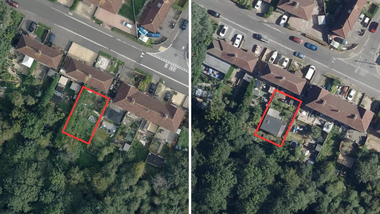
Why Change Detection Analysis leveraging Aerial Photography is Essential for Planning Compliance
Built environments are changing rapidly which means planning departments face the dual challenge of enabling growth while ensuring developments remain within agreed parameters. One of the most powerful tools available…
Read More -
AI, Data, and the Power of Provenance: Turning Information into Insight Responsibly
by Rachel Tidmarsh I recently had the pleasure of joining a panel at Intergeo, where we explored "Data to Decisions: The Role of AI and Machine Learning in Transforming Large…
Read More
June 2025
-
The importance of Early Warning Systems: the role of geospatial data in flood management in the UK
The impact of climate change is a hot topic with unpredictable weather patterns being recorded across the globe. With every degree of warming there are more frequent and intense weather…
Read More
April 2025
-
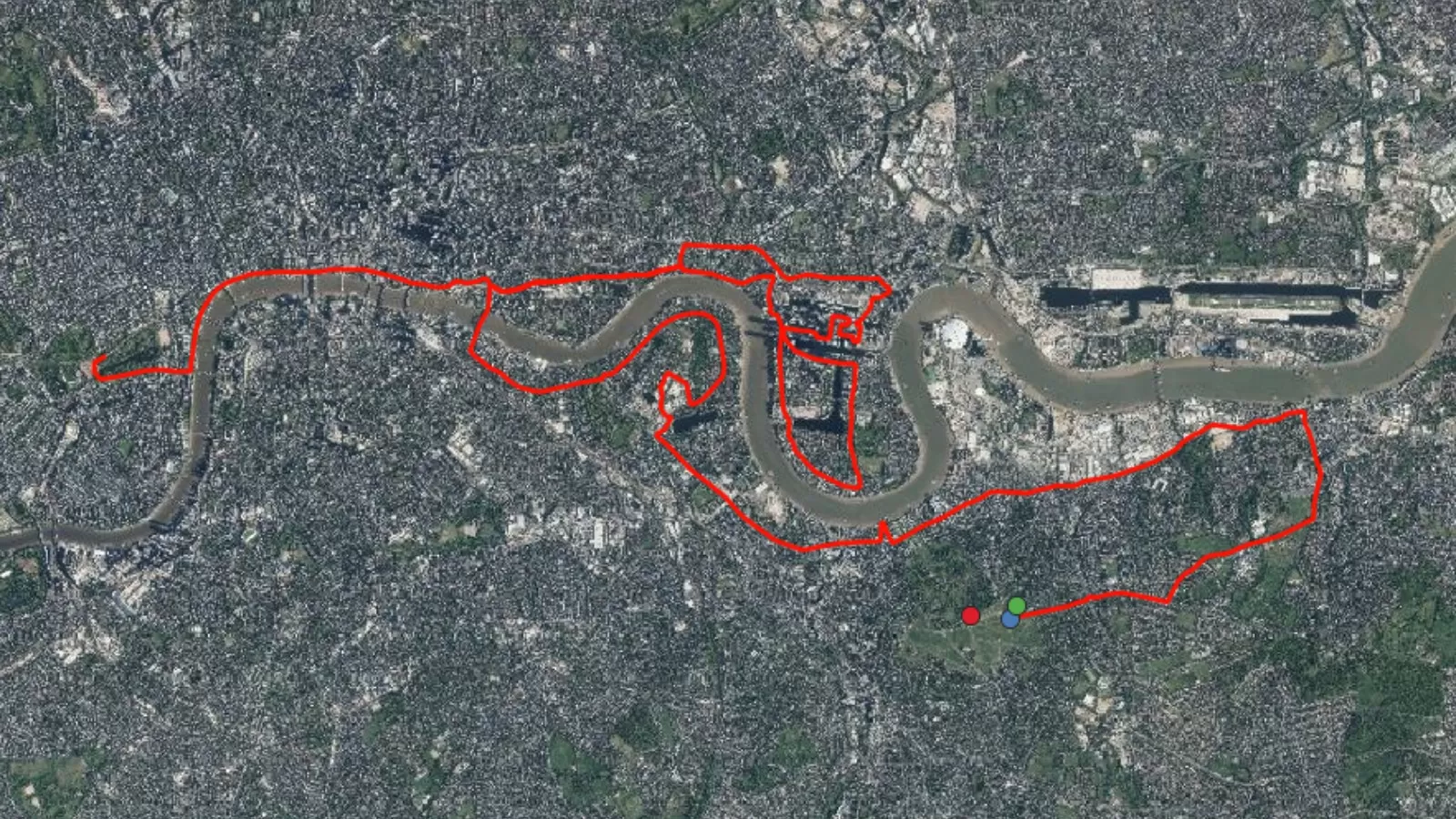
The London Marathon: How Geospatial Data can Support Large Events
by Alice Hilton The London Marathon, first held in 1981, has grown into one of the world’s most prestigious long-distance running events. Every April, tens of thousands of runners —…
Read More
February 2025
-
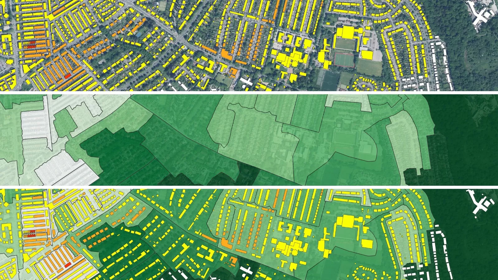
The Importance of Urban Greening: Mapping the 3+30+300 Rule Using Geospatial Data
by Alice Hilton Over half of the world’s population currently live in urban areas, many of which are complex and face issues such as dense population, congestion, and access to…
Read More
December 2024
-
EAASI Summit: Insights from an EAASI Young Ambassador
by Alice Hilton Last month I attended the EAASI Summit in Athens as a Young Ambassador. Over the course of the three-day event, I participated in discussions about the future…
Read More -
30 Day Map Challenge 2024
by Alice Hilton After a busy month, I have completed the 30 Day Map Challenge! Out of the 30 themes, I created 23 maps, each showcasing a different story, perspective,…
Read More
October 2024
-
Transforming Urban Landscapes: The Role Of Geospatial Data In Driving Sustainable Urban Development
by Alice Hilton In 2013, the United Nations (UN) designated 31st October as World Cities Day to promote global sustainable urban development with the aim to raise awareness about global…
Read More -
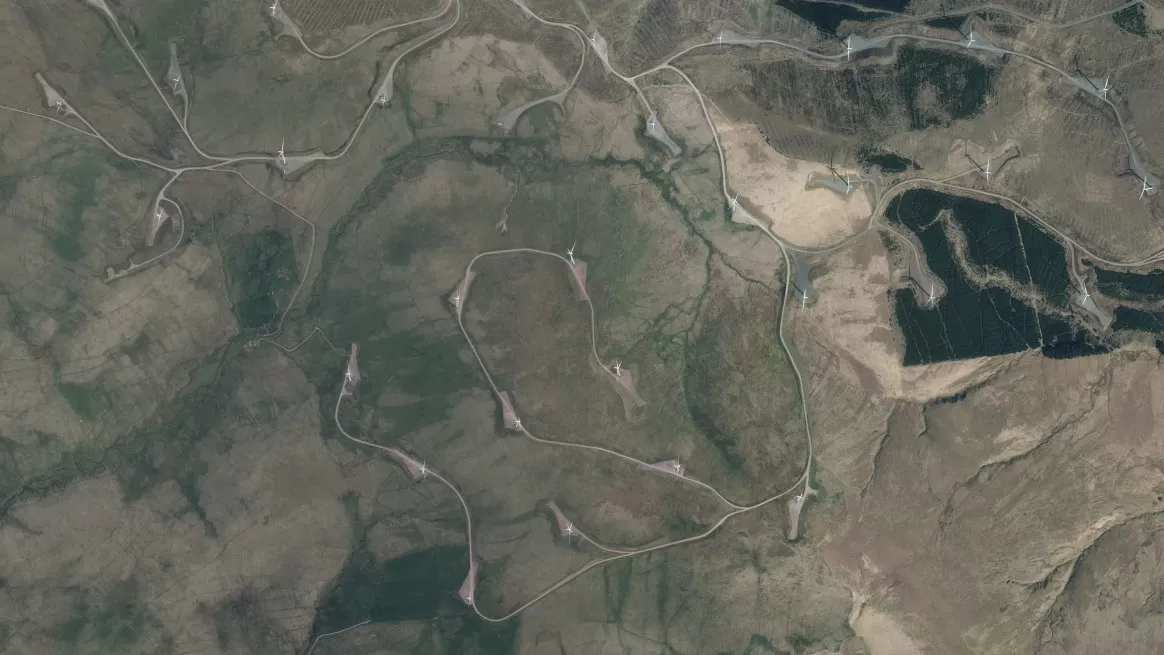
How Geospatial Data is Transforming the Renewable Energy Sector and Guiding Strategic Decisions
by Alice Hilton Renewable energy is a crucial pillar in the global battle to mitigate climate change and achieve long term sustainability goals. Unlike fossil fuels, which release significant amounts…
Read More
September 2024
-
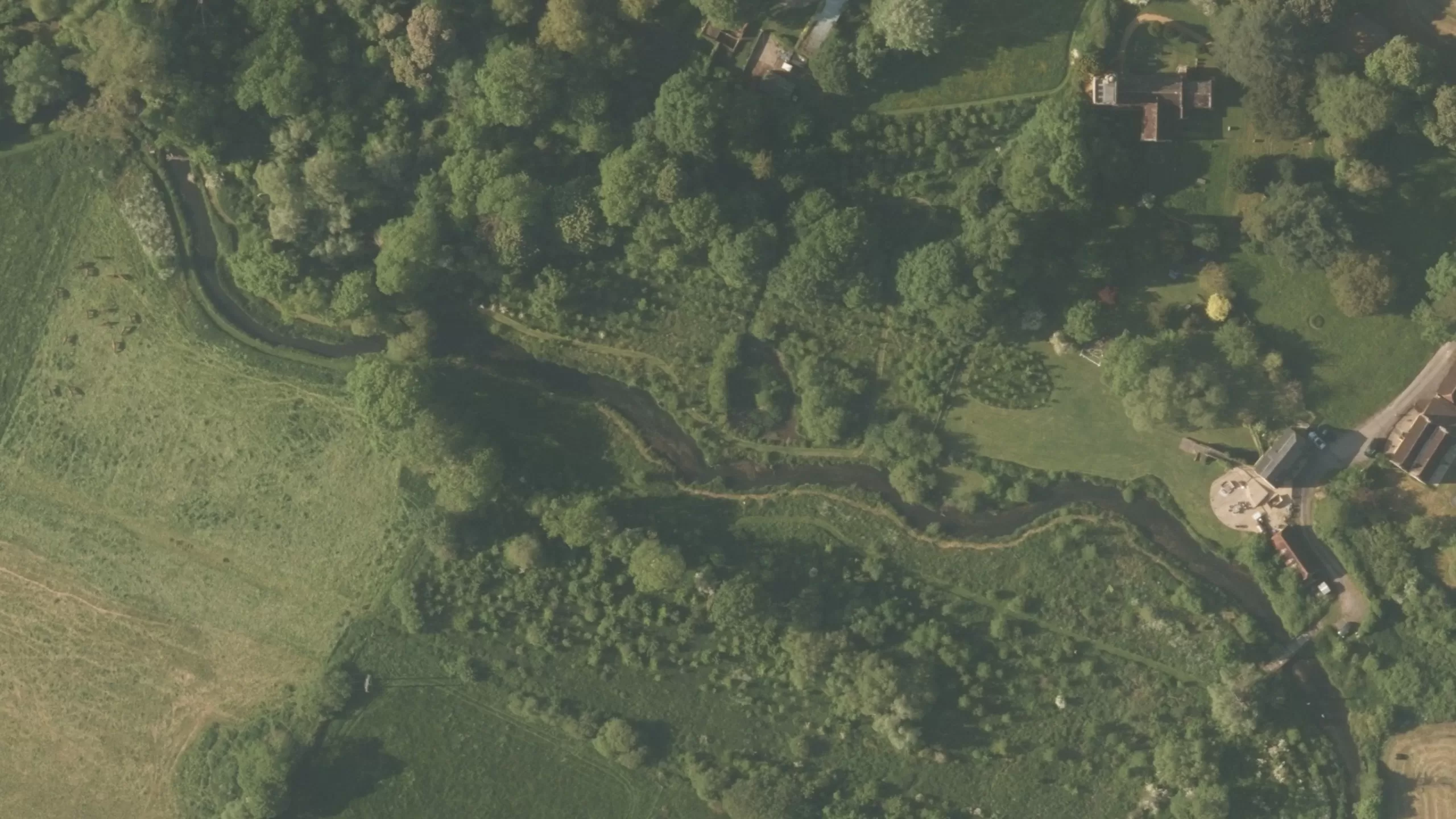
Reviving the River Wylye: A Decade of Chalk Stream Restoration
by Alice Hilton To view the original post on ArcGIS StoryMaps click here
Read More
August 2024
-
The Significance of Geospatial Data in Mapping and Monitoring Tree, Hedgerow, and Woodland (THaW) Ecosystems
by Alice Hilton Tree, hedgerow and woodland (THaW) ecosystems are key components of the UK’s complex and interconnected ecosystem[1]. All are historically and ecologically important providing crucial habitats and habitat…
Read More
August 2023
-
Renewable Energy Planning in Ireland
With ambitious plans to tackle climate change, Ireland has already seen a dramatic increase in energy generated from renewable resources yet there is still a growing demand that is not…
Read More